TREKKING AND TRAIL RUNNING IN ECUADOR
Ecuador with incredible amounts of untouched nature is a perfect destination for trekking and trail running. Especially trail running became very famous lately: many clubs are being formed, a national association has been created, the number of competitions is rising and the number of runners as well.
Andean Summit Adventure is part of the scene. We are members of BTR - Baños Trail Running, the local club in Baños de Agua Santa and interact a lot with the national trail running community. We can give you a hand with organizing participation in trail running events and competitions in Ecuador or just accompanying you in your trail running or trekking holidays.
Below you will find a choice of routes which are perfect for trekking or trail running and off the beaten treks.
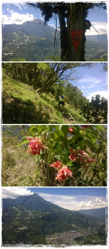
Cara de Perro (Dog's Face, Hundegesicht) in Baños de Agua Santa
Start: Baños de Agua Santa (1.800 m)
End: Baños de Agua Santa (1.800 m)
Route Length: approx. 15 km
Elevation Gain: approx. 1.000 m
Lowest Point: 1.692 m
Highest Point: 2.445 m
Duration Trek: 5 - 7 hours
Views & Landscape (out of 5): 


Difficulty (out of 5): 


Equipment: GOOD hiking or trail running shoes with grip, long pants, eventually trekking poles, small back bag, food & drinks for the whole route (ideally cereal bars, bananas, sports drinks etc.), spare cloths, rain jacket, sun screen, sun glasses
Best season: September - December, January - May
Description: The tour starts in the center of Baños, first going down along the road direction Ulba, where the ascent begins. After the first, paved section, the route follows old, not very transited farmer's paths (that's why long pants are recommendable). Partly the route is very steep, exposed and leads through rocky sections, therefore it's essential to have good shoes and confidence in difficult terrain. The ascent is along the ridge with slight ups and down till at 2.445 m the path leads us downwards through cultivations of fruits and vegetables. The last part shares the route "Los Sauces" with marvellous views of Baños as well as volcano Tungurahua (5.016 m). Views are amazing throughout the whole trail. We come back to Baños via San Francisco Bridge.
The route is very demanding, suitable only for advanced and expert trekkers and trail runners. Bad weather can complicate activities on the route - so make sure to be prepared and that your back bag is well packed!
Hacienda Releche - Refuges Capac Urcu - Laguna Amarilla (Yellow Lagoon) - Altar volcano
Start: Hacienda Releche (approx. 2.900 m)
Camp: Refuges Capac Urcu (approx. 3.800 m)
End: Hacienda Releche (approx. 2.900 m)
Route Length: approx. 30 km
Elevation Gain: approx. 1.500 m
Lowest Point: approx. 2.900 m
Highest Point: approx. 4.250 m
Duration Trek: 3 days (recommendation)
Views & Landscape (out of 5): 


Difficulty (out of 5): 


Equipment: GOOD hiking or trail running shoes with grip, rubber boots in case of wet weather, eventually trekking poles, back bag with equipment for 3 days (incl. sleeping bag), food & drinks for the whole route (ideally cereal bars, bananas, sports drinks etc.), spare cloths, rain jacket, sun screen, sun glasses
Best season: November - December, January - February, June - August
Description:
3-day-tour the programme is as follows:
Day 1: Transfer from Baños to Hacienda Releche, where we start the 11 km trek (with approx. 900 m elevation gain) up to refuges Capac Urcu - our base camp for the trek. Average tour time for the ascent through Collanes Valley up to the hut is around 5 - 7 hours.
Day 2: Ascent from refuges Capac Urcu to Laguna Amarilla. The path up is quite steep and ascent time is around 2 hours (approx. 400 m elevation gain). It's possible to walk down to the lagoon. Descent to the refuge.
Day 3: Descent to Hacienda Releche and transfer back to Baños.
Wonderful landscapes and the view of Altar volcano make this an extraordinary trek. Due to climate conditions the route is often very challenging (river crossing, mud etc.).
For an intense trail running day conditions have to be very good. If this is the case, experienced trail runners with good physical condition can make it in 1 day.
Patate - Scenic Tour with cascade of Munduk
Start: Patate (2.172 m)
End: Patate (2.172 m)
Route Length: approx. 20 km
Elevation Gain: approx. 1.000 m
Lowest Point: 2.172 m
Highest Point: 3.156 m
Duration Trek: 5 - 7 hours
Views & Landscape (out of 5): 


Difficulty (out of 5): 

Equipment: GOOD hiking or trail running shoes with grip, long pants, eventually trekking poles, small back bag, food & drinks for the whole route (ideally cereal bars, bananas, sports drinks etc.), spare cloths, rain jacket, sun screen, sun glasses
Best season: all year long
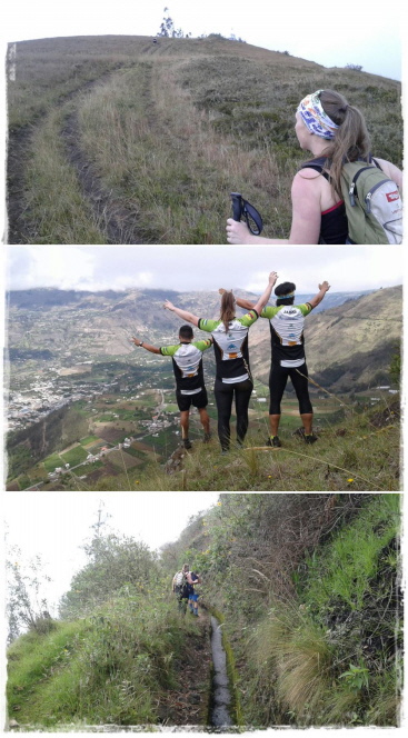
Description: The tour starts in the center of Patate and leads us first through cultivations of fruits and vegetables continuously upwards to the grasslands around Patate. After about 7 km we reach the viewpoint of the Munduk water fall from where we still ascent to a max. elevation of approx. 3.200 m. The paths are of moderate difficulty and the views spectacular: we see the cities of Pelileo and Ambato, the hills of the area and are overlooking Patate during the descent.


 Print
Print RSS
RSS